Imagery sets
The Bind Maps Rest Provider imagery service supports different types of visualization.
The Bing Maps REST Services is deprecated. The BingRestMapProvider will be supported until 2026 Q2 inclusive. To avoid disruptions, you can use the Azure Maps Services, which are supported by the RadMap control via the AzureMapProvider.
The possible imagery sets which can be used are:
- Aerial with Labels
- Aerial without Labels
- AerialOnDemand
- Road
- RoadOnDemand
- Birdseye
- CanvasLight
- CanvasGray
- CanvasDark
To choose an imagery set, you can set the Mode property of the BingRestMapProvider.
Example 1: Setting Mode property in XAML
<telerik:RadMap>
    <telerik:RadMap.Provider>
        <telerik:BingRestMapProvider x:Name="bingRestMapProvider" ApplicationId="Bing_Map_Key" Mode="Aerial"/>
    </telerik:RadMap.Provider>
</telerik:RadMap>
Example 2: Adding CanvasGray mode to the view mode commands bar
public MainWindow()
{
    InitializeComponent();
    this.bingRestMapProvider.RegisterSetSourceCommand(MapMode.CanvasGray, LocalizationManager.GetString("MapCanvasGrayCommand"));
}
Example 3: Remove mode from the view mode commands bar
public MainWindow()
{
    InitializeComponent();
    this.bingRestMapProvider.Commands.RemoveAt(0);
}
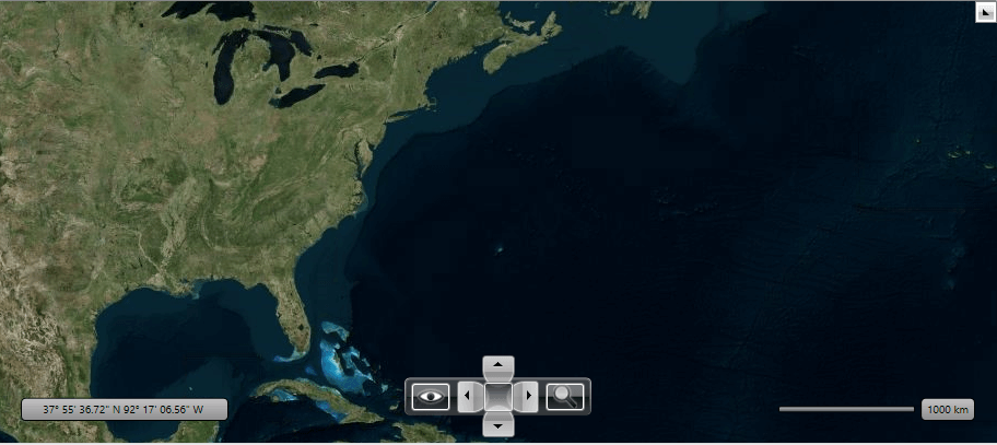
Aerial with Labels
This mode offers worldwide orthographic aerial and satellite imagery. The labels in this mode are enabled by default.
Figure 1: Aerial mode with labels
Aerial without Labels
You can the disable labels using the IsLabelVisible property. When you set it to False the labels disappear. Figure 2 is a snapshot of the Aerial mode for Bing Map Rest Provider when the labels are not visible.
Figure 2: Aerial mode without labels
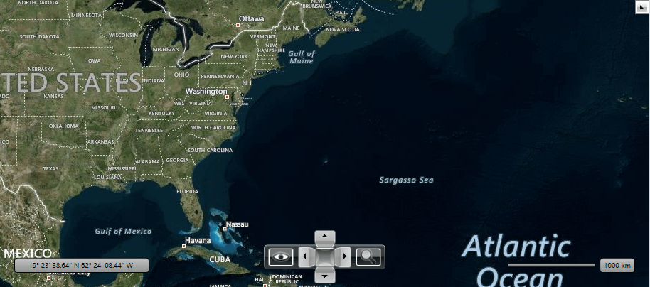
AerialOnDemand
This imagery set represent Aerial imagery with on-demand road overlay.
Figure 3: AerialOnDemand mode
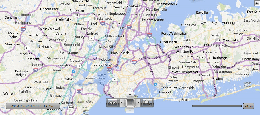
Road
The road imagery type is a set of static tile server. The tiles are generated ahead of time and then stored and served. The Road mode of Bing Maps ignores the IsLabelVisible property. For this mode the labels are displayed always. Figure 4 is an example of the Road Mode definition.
Figure 4: Road mode
Birdseye
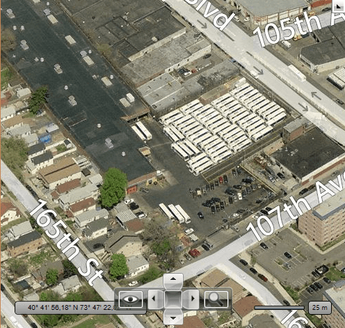
The Bing Map Rest Provider also supports the Birdseye mode. This mode can be used for high resolution levels only (zoom level 19-20).
The Birdseye mode does not provide the tile images for all regions around the world. Some regions don't have images for Birdseye mode.
Here is an example of the Birdseye Mode definition:
Figure 5: Birdseye mode
RoadOnDemand
The road on demand imagery type provides the same map tiles used in the latest Bing maps controls. These tiles are generated on the fly as needed and are the most up to date road maps.
Figure 6: RoadOnDemand mode
CanvasLight
A light version of the road maps which provides neutral background with minimal colors, labels and features.
Figure 7: CanvasLight mode
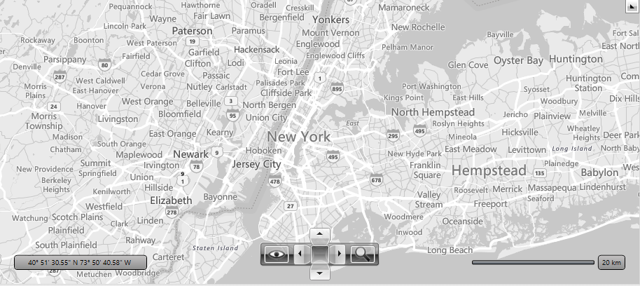
CanvasGray
A gray version of the road maps which provides neutral background with minimal colors, labels and features.
Figure 8: CanvasGray mode
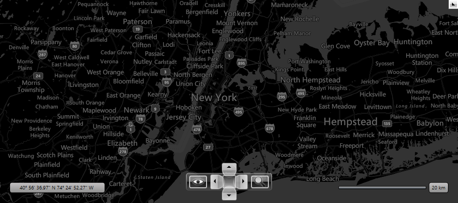
CanvasDark
A dark version of the road maps which provides neutral background with minimal colors, labels and features.
Figure 8: CanvasDark mode