ArcGIS Online Map Provider
The ArcGIS online services can be used via the ArcGisMapProvider class.
To use the ArcGIS vector tile services refer to the Migrating to Vector Tile Map Provider section of this article.
Currently the ArcGIS map provider support six modes which specify the type of appearance of the map can and be set using the Mode property:
- Aerial
- Physical
- Shaded Relief
- Street
- Terrain
- Topographic
The following example of the ArcGisMapProvider definition uses the Physical mode:
<telerik:RadMap x:Name="radMap" ZoomLevel="1">
    <telerik:RadMap.Provider>
        <telerik:ArcGisMapProvider Mode="Physical" />
    </telerik:RadMap.Provider>
</telerik:RadMap>
ArcGisMapProvider provider = new ArcGisMapProvider();
provider.Mode = ArcGisMapMode.Physical;
this.radMap.Provider = provider;
Dim provider As New ArcGisMapProvider ()
provider.Mode = ArcGisMapMode.Physical
Me.radMap.Provider = provider
As of April 16, 2019, ArcGIS Online services only accept connections using TLS 1.2. Thus, you need to explicitly set the ServicePointManager.SecurityProtocol property if you're using a .NET Framework version prior to 4.7.
public App()
{
    // ArcGis rest services require TLS 1.2 protocol.
    ServicePointManager.SecurityProtocol = (SecurityProtocolType)3072;
}
Partial Public Class App
    Inherits Application

    Public Sub New()
        ' ArcGis rest services require TLS 1.2 protocol.
        ServicePointManager.SecurityProtocol = CType(3072, SecurityProtocolType)
    End Sub
End Class
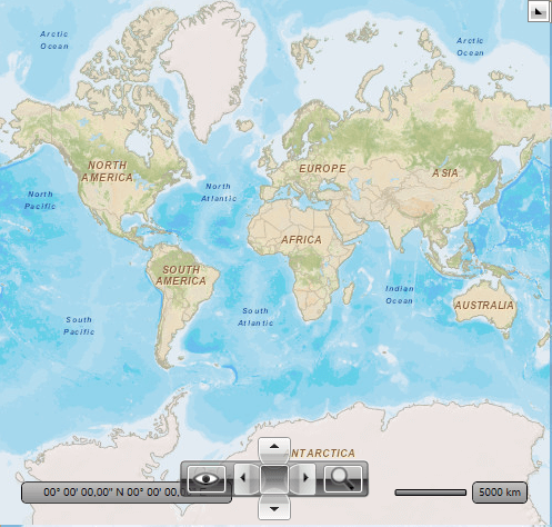
Here is a snapshot of the map that appears when using the Physical mode:

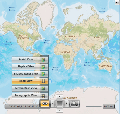
For comparison, the following snapshot demonstrates the appearance of the map for the Street mode:
The ArcGisMapProvider also allows the user to change the map mode using the Map View button of the toolbar.